Yahoo Answers is shutting down on May 4th, 2021 (Eastern Time) and beginning April 20th, 2021 (Eastern Time) the Yahoo Answers website will be in read-only mode. There will be no changes to other Yahoo properties or services, or your Yahoo account. You can find more information about the Yahoo Answers shutdown and how to download your data on this help page.
Trending News

I have to do the cloud Cirrus Uncinus?
I have to do a report on the cloud Cirrus Uncinus, we have a book but no where in there has any information on it and I cant find any of it online either. I need geographical location, height, formation, assc. weather, weather hazards, symbol, and height level ( low, middle, or high). I have gone through the book at least 50 times and cant find anything. Your help is appreciated.
2 Answers
- 7 years agoFavorite Answer
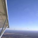
Cirrus uncinus is a type of cirrus cloud. The name cirrus uncinus is derived from Latin, meaning "curly hooks". Also known as mares' tails, these clouds are generally sparse in the sky and very thin.
https://spark.ucar.edu/imagecontent/cirrus-clouds
- TQLv 77 years ago
Distribution: Worldwide.
Height: Above 16,500 feet.
Cause: Saturation of air mass at upper levels, combined with strong wind immediately below cloud level.
Associated Weather:
May indicate an approaching frontal system.
This often spectacular variation of cirrus cloud is also known as hooked cirrus (uncinus is the Latin for hook), or cirrus mares' tails, a reference to the cloud's resemblance to a horse's tail.
Cirrus uncinus forms in much the same way as other cirrus formations. However, its distinctive pattern of filaments is the result of a high-speed wind below the level at which the ice crystals form. As the crystals descend under the influence of gravity, this wind rapidly smears them across the sky, forming the distinctive, elongated, hooked shapes.
Like other cirrus clouds, uncinus is a result of high-level moisture, and is therefore often associated with the approach of a frontal system. Since it is also evidence of a high-speed, high-level wind, it may indicate the presence of a jet stream.
Normally, cirrus uncinus produces no significant weather on the ground, although snow showers may be visible immediately below cloud level. These usually evaporate well before reaching the ground and are therefore classified as virga.
As cirrus uncinus generally indicates the presence of high- speed winds, pilots often associate this cloud with turbulence. In most cases, however, the turbulence would cause little discomfort to pilots or passengers.
Image: cirrus cloud symbols
.
 Source(s): National Weather Service forecaster